| Data Updated: |
Monday, April 9, 2012 2:35:40 PM |
| Trip: |
Appalachian Trail
Deep Gap, NC to Rock Gap, NC - Overnight Backpack Trip |
| Status: |
Confirmed & Planning
Trip goes rain or shine, unless weather conditions will be severe or extreamly wet. |
| Date: |
April 27 - 29, 2012
|
| Trip Host: |
Jeremy Landers
770-861-8175 |
| Location: |
Appalachian Trail
Macon County NC
Clay County TN |
| Cost: |
Carry cash for fuel sharing. |
| Difficulty: |
Strenuous
(Elevation gain 1,157 ft in 2.5 miles, 460 ft elevation gain in 0.2 miles)
See options below for day hike difficulty |
| Length: |
Complete Hike
20.7 Miles over three days
8.5 Miles on Day 1
6.8 Miles on Day 2
5.4 Miles on Day 3
Optional Day Hikes Only
Below you will find several options for day hikes ranging in difficulty from easy / moderate to strenuous. If you are interested in any of the options below please let Jeremy know so we can work on the logistics on meetups.
Friday:
Friday Option #1:
Hike with us from Deep Gap to Standing Indian Shelter. Approx 1.6 mile moderate round trip hike.
Friday Option #2
Hike with us from Deep Gap to summit of Standing Indian Mountain, enjoy lunch & views, then turn around & head back on your own to Deep Gap. Approx 5 mile round trip strenuous hike. (Elevation gain 1,157 ft in 2.5 miles)
-----------
Saturday:
For those interested in a remote and rather strenuous day hike, this option is a possibility depending on Forest Service Road Conditions. 3.2 mile round trip hike from Mooney Gap USFS 83 to the summit of Albert Mt and back. (Elevation gain 829ft in 1.6 miles). Fire Tower with excellent views.
NOTE:
If you are meeting us on Saturday it will be VERY critical that you be at the appointed meetup location on time. We will not have daylight hours to wait for your arrival beyond the appointed time. Please let Jeremy know as soon as possible if you are considering this route. Access is from a diffrent Forest Service Road and we will need to do some research and plan access logistics.
-----------
Sunday:
Hike in on your own from Rock Gap Parking Area USFS 67 (Paved) & meet up with us at Glassmine Gap or whenever you encounter us and complete the hike with us. Approx 5.2 mile round trip easy to moderate hike.
|
| Blaze: |
White Rectangle (Appalachian Trail) |
| Departs From: |
Quillians Corner Chevron |
| Departure Time: |
6:30 am Meet up at Quillians Corner
6:45 am Departs Quillians Corner Chevron
|
| Meals: |
Bring adequate food for 2 breakfasts, 3 lunches, 2 dinners as well as any snacks. You should be prepared to properly store your food overnight to prevent critters & bears from getting your food supply.
(Click Here For A YouTube Video On How To Hang A Bear Bag)
Odor Proof Bags can be purchased at www.simpleoutdoorstore.com
These bags work great!
Please note: ZipLoc bags are NOT odor proof! However using regular ZipLoc bags inside of a larger Odor Proof Bag is a great way to cut down on cost and keep your food separated!
|
| Transportation: |
POV's with carpooling, or drive on own. If you need transportation you can post an email to the hike group email list.
(Always be prepared to drive your own vehicle if necessary. If you carpool, fuel costs should be shared.)
Car Drop at Each Trail End |
| GPS Info: |
The GPS files & related links below are provided as a courtesy. Pleases verify all route & waypoint information before headding out on the trail.
To decompress the Zipped files, you will need a decompression program, such as UnStuffit, WinZip or PKZip.
 Deep-Gap-To-Rock-Gap.gpx (April 2012) Deep-Gap-To-Rock-Gap.gpx (April 2012)
Other Sources
http://www.trimbleoutdoors.com/ViewTrip/1066370
GPS / GIS Data From ATC |
| USGS Quad: |
|
| Ranger District: |
Nantahala Ranger Dist. Nantahala National Forest, Formerly the Wayah District . |
| Schedule: |
DAY 1
6:30am Meet at Quillians Corner Chevron
6:45am Dept. Quillians Corner Chevron
7:00am McDonalds Cleveland, Ga
7:15am Depart McDonalds
8:00am Restroom break Hiawassee, Ga.
8:15am Depart Hiawassee, GA
9:00am Arrive at Rock Gap (Vehicle Drop)
9:45am Arrive at Deep Gap Trailhead
10:00am Safety Briefing & Begin Hike
10:45am Standing Indian Shelter
11:50am Standing Indian Mt.(Day Hikers Turn Back) LUNCH
12:30pm Depart Standing Indian Mt.
2:15pm (Day Hikers arrive back at Deep Gap & depart for Gainesville)
2:45pm Beech Gap
4:15pm Coleman Gap
5:00pm Junction with Blue Blazed Timber Ridge Trail on Left
5:30pm Carter Gap Shelter
8:16pm Approx Sunset
--------Setup camp, filter water, cook supper, etc.... Bed!
DAY 2
8:00am Breakfast, Clean up Breakfast, Re-Supply Water, Break Camp, etc....
9:30am Depart Carter Gap
10:45am Unmarked trail to right leads to vista
1:15pm Betty Creek Gap LUNCH
2:00pm Mooney Gap USFS 83 Campsites (Day Hiker Meetup?)
3:00pm Bear Pen Gap
3:15pm Junction with Bear Pen Trail & Albert Mt. Bypass Trail
4:00pm Summit of Albert Mt. Firetower with views
5:00pm Big Spring Gap Shelter
--------Setup camp, filter water, cook supper, etc.... Bed!
6:00pm (Day Hikers Return to Mooney Gap USFS 83 & return to Gainesville)
8:17pm Approx. Sunset
DAY 3
8:30am Breakfast, Clean up Breakfast, Re-Supply Water, Break Camp, etc....
10:00am Depart Big Spring Gap Shelter
11:30am AT Crosses Stream
12:00pm Glasmine Gap (Meet Up with Day Hikers) LUNCH
1:30pm Unreliable Spring,
2:30pm Junction with Rock Gap Shelter Trail
2:40pm Arrive at Rock Gap Parking Area, load vehicles
3:00pm Depart Rock Gap.
3:45pm Pick up vehicles at Deep Gap (If needed)
4:15pm Arrive at intersection of Deep Gap Road & Hwy 64
5:00pm Hiawassee, GA (Supper - Optional)
5:30pm Depart Hiawassee
6:15pm Cleveland Ga - Restroom Break
6:20pm Depart Cleveland
6:40pm Arrive Quillians Corner Chevron
All times are approximate and are subject to change without notice!
|
| Trail Description: |
| Miles by Day |
Miles
To Rock Gap |
Miles From Deep Gap |
Trail Description |
GPS
(Locations are approximate & unverified) |
| 8.5 |
20.7 |
0.0 |
Deep Gap, NC (4,341 feet) parking area USFS 71 the AT exits to the east of the parking area between two logging roads.
Note: Kimsey Creek Trail Leads left 3.7 miles to Standing Indian Campground. (Blue Blaze) |
35.039818,
-83.552368 |
| 8.1 |
20.3 |
0.4 |
Spring to west, Campsite (4560ft) |
|
| 7.7 |
19.9 |
0.8 |
Standing Indian Shelter (Privy), Left of Trail , Stream. Continue climbing on grassy road. (4,760ft) |
35.041733,
-83.547997 |
| 7.3 |
19.5 |
1.2 |
Spring (4837ft) |
|
| 6.1 |
18.3 |
2.4 |
Trail to spring on left. 100ft further junction with lower Ridge Trail (Blue Blaze). To right trail leads 600ft to summit of Standing Indian Mt. (5498 ft) Campsites on summit trail. To left trail leads 4.2 miles to Standing Indian Campground. |
35.036133,
-83.537498 |
| 4.2 |
16.4 |
4.3 |
Spring (4939ft) |
|
| 3.2 |
15.4 |
5.3 |
Beech Gap (4,460ft), Clearing with campsites (7 Tents). Seasonal water100ft to right of trail. To left Beech Gap Trail (Blue Blaze) leads 2.8 miles to USFS 67. Continue on mostly level trail & cross several streams |
35.009998,
-83.525734 |
| 2.1 |
14.3 |
6.4 |
Stream (4405ft) |
|
| 1.4 |
13.6 |
7.1 |
Coleman Gap (4226ft) |
35.005432,
-83.509949 |
| .04 |
12.6 |
8.1 |
Junction with Timber Ridge Trail on left (Blue Blaze) (4635ft). This trail leads 2.3 miles to USFS 67, 4.4 miles south of Standing Indian Campground (Campsite 2 Tents nearby) |
35.002899,
-83.499016 |
0.0
--
6.8 |
12.2 |
8.5 |
Carter Gap (4520ft), Level area with campsties. Blue Blazed Trail to left leads to Old Carter Gap Shelter. The new shelter is on opposite side of trail.150 ft behind old shelter is reliable spring. Begin ascent to shoulder of Ridgepole Mt. |
34.999920,
-83.497020 |
| 6.3 |
11.7 |
9.0 |
Stream (4766ft) |
|
| 5.7 |
11.1 |
9.6 |
Spring (4933ft) |
|
| 5.4 |
10.8 |
9.9 |
Bear left on Little Ridgepole Mt. |
|
| 5.1 |
10.5 |
10.2 |
Trail to right leads approx. 25 feet to great vista. |
|
| 3.1 |
8.5 |
12.2 |
Betty Creek Gap, (4300ft) clearing with campsites (4 Tents). AT continues through clearing. Spring 0.2 mile to left of clearing via blue blazed trail & USFS 67 aprox 6.3 miles on Betty Creek Gap Trail. |
35.0281479, -83.4784895 |
| 2.2 |
7.6 |
13.1 |
Mooney Gap, (4496ft) USFS 83 Ball Creek Rd. Trail crosses road. Campsites. To right road leads to Coweeta Hydrological Lab and US 441 To left leads to USFS 67. Trail leaves wilderness area. |
35.035782,
-83.470398 |
| 2.1 |
7.5 |
13.2 |
Spring above trail. After crossing culvert trail angles left & up some log steps leaving old road begin ascent. |
|
| 1.9 |
7.3 |
13.4 |
Trail Crosses above cliff while climbing steep rocky east face of Big Butt Mountain, views into Coweeta valley below. |
|
| 1.3 |
6.7 |
14.0 |
Bearpen Gap. USFS 67 nearby |
35.046848,
-83.471535 |
| 0.9 |
6.3 |
14.4 |
Junction with two trails on left (blue blazes). (4841ft) Bear Pen Trail goes straight left across USFS 67 then descends to USFS 67 (2.5 miles). The bypass (Blue Blaze) around Albert Mountain turns right and follows the road. Continue straight on AT and climb the steep, strenuous, rocky southern side of Albert Mountain. |
|
| 0.6 |
6 |
14.7 |
Albert Mountain Summit (5,250 ft), Firetower with views |
35.052700,
-83.477501 |
| 0.4 |
5.8 |
14.9 |
Junction on left with Northern end of Albert Mt. bypass trail (Blue Blaze) (5040ft) Reliable spring 1,000 ft down bypass trail. |
|
0.0
--
5.4 |
5.4 |
15.3 |
Big Spring Gap.(4973ft)
Blue Blazed trail to left leads 250 ft. to Big Spring Gap Shelter. (Privy, Cables) 75ft beyond shelter is water.
Downhill to right is Little Pinnacle Trail (Blue Blaze) leading to Coweeta. Also to right is 0.2 mile trail to overlook on Pinnacle Mt. AT turns slightly left. |
35.059032,
-83.478630 |
| 4.1 |
4.1 |
16.6 |
Long Branch Shelter (2012) (4503ft)
Not sure if this shelter is active yet |
|
| 3.4 |
3.4 |
17.3 |
AT crosses stream. |
|
| 2.6 |
2.6 |
18.1 |
Glassmine Gap opens in a small clearing. Blue Blazed Long Branch Trail descends to left 2.3 miles to USFS 67. |
35.079449,
-83.507187 |
| 1.6 |
1.6 |
19.1 |
Unreliable spring to left of trail. Several campsites & unreliable water sources within the next mile or so. |
|
| 0.1 |
0.1 |
20.6 |
Junction with Blue Blazed Rock Gap Shelter Trail. 300ft to Shelter & two springs. (Privy, Cables) (3787ft) |
35.091534,
-83.523018 |
| 0.0 |
0.0 |
20.7 |
Parking area at Rock Gap.(3757ft)
Paved USFS 67 leads left one mile to Standing Indian Campground. To right 0.5 mile Wallace Gap. Side trail to right leads 1.7 mile (RdT) to the John Wasilik Memorial Poplar. (This tree, now dead, is the second largest yellow-poplar in the United States, with an 8.6-foot diameter and a 27-foot circumference).
AT bears to right. |
35.094234,
-83.522453 |
|
| Equipment Requirements: |
Please note this is a multi day / overnight hike. Each hiker is responsible for providing their own gear (tent, sleeping bag, cookware, food, clothing, rain gear, food storage, first aid, etc....). If you need assistance with equipment please contact one of the co-chairs. |
| Hunting Season: |
Please note that it will be Firearm Turkey Hunting Season in North Carolina while we will be hiking. |
| General Notes: |
Walk at your own pace! Try to walk with someone when possible and try to stay in sight or sound of the main group which means the lead hikers may need to slow or stop to let the rear hikers catch up. This is a good reason to carry a whistle on you at all times. Lead hikers should stop at all trail intersections to let everyone gather before moving forward.
If you need a potty break while on the trail, just let someone know you are leaving the trail for a few moments and have that person wait nearby until you return. If you should feel ill or become weak while hiking, let Jeremy or Marsha know immediately. Do not push yourself forward on the trail under adverse conditions. One of us will work with you to maintain your safety. If you have any medical concerns that need to be known, be certain a hiking partner or Jeremy/Marsha know about any issues that could require immediate attention.
Carpoolers should share the cost of fuel when returning to their base location.
If you have any questions regarding the logistics for this hike, please contact Jeremy Landers. If you are signing up to hike or have transportation issues, contact Jeremy Landers. More info on our hiking plans can be found at: www.LandersStudions.com/gechike
PLEASE - DO NOT CONTACT THE CHURCH OFFICE REGARDING THE HIKES. THE CHURCH OFFICE DOES NOT HANDLE OUR PLANS NOR ROSTER FOR THIS ACTIVITY. CONTACT JEREMY OR MARSHA DIRECTLY.
Marsha: Email
Jeremy: Email or (770-861-8175 Cell)
Marsha
HIKE AT YOUR OWN PACE - BUT HIKE WITH A PARTNER OR IN SIGHT OR SOUND OF YOUR GROUP FOR SAFETY.
|
| Links & Ref. |
North Carolina Ranger Districts
National Forest Service Alerts - NC
Nantahala National Forest - Wayah District - Motor Vehicle Use Map- PDF
|
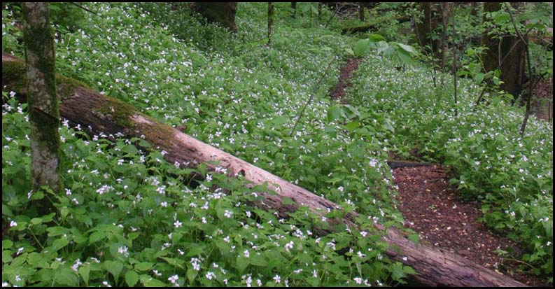
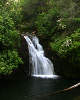
Photos
(NOT GEC Hike Group) |
|
Photos by
GEC Hike Group |
|
| Map |
Nantahala National Forest - Wayah District - Motor Vehicle Use Map- PDF
Interactive AT Map from the ATC
|
| Directions: |
Deep Gap -- Reached via highway US64 and USFS 71. Follow US64 East past Hayesville, NC, make long climb up mountain, and near top of second climb, watch for sign for FS71 on right. FS71 is a 6-mile single-lane gravel road, normally quite passable for autos. Follow FS71 to parking area at end; the AT crosses through this parking area. To go South on AT, head West out of parking area -- to go North, head East.
Rock Gap Parking Area -- From US 64 turn right onto Old Murphy Road "Old 64" turn right on paved USFS 67, then 0.5 mile south to parking area. |
|
|
| Reservations: |
Contact Jeremy Landers
770-861-8175
Deadline: Sunday April 22, 2012 - 5pm
*Special Notice Regarding Hikers Under 18 Years of Age!
|
| Post Trip Review: |
|
|
|